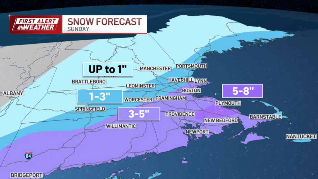
A coastal storm is bringing a widespread, wet snowfall to much of southern New England today, with accumulation starting late morning and heaviest snowfall rates occurring late afternoon and evening. Most areas can expect 2–5 inches, with localized spots in southeastern Massachusetts and Rhode Island potentially seeing up to 6 inches. Travel impacts are expected to be hazardous, including slippery roads and reduced visibility. A winter weather advisory is in effect through 7 a.m. Monday.
Following the storm, an arctic front will move in Monday night, bringing the coldest stretch of the week for Tuesday and early Wednesday. Temperatures are expected to be well below normal, with wind chills near or below zero. Conditions will moderate slightly by mid-week.
Read More

